Below Eyjafjallajökull
Eyjafjallajökull is an ice-capped volcano that erupted in 2010.
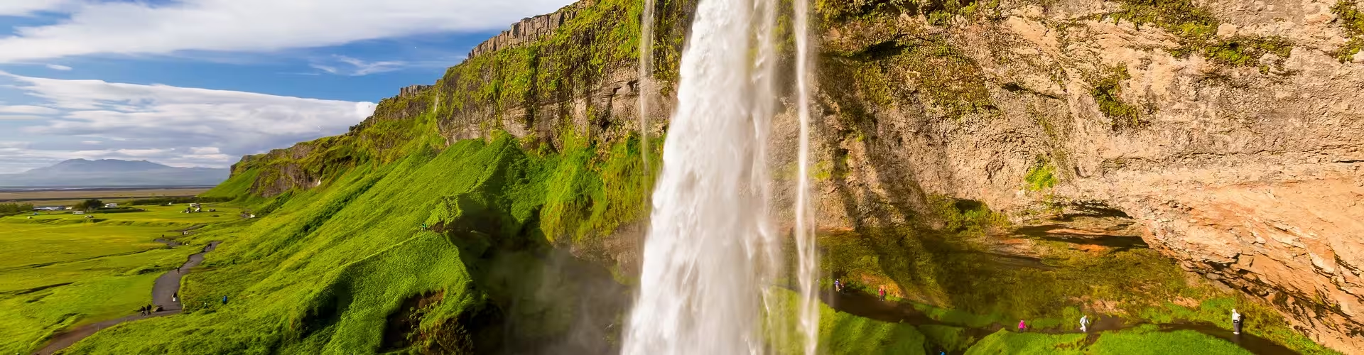
Seljalandsfoss is 60 metres (197 ft) high, and a footpath runs behind it at the bottom of the cliff. A little further west is Gljúfrabúi, partially masked by its canyon.
Day trips along the south coast, such as the South Coast Day Trip from Reykjavik: Waterfalls & Glaciers, stop at Seljalandsfoss.
Skógafoss and the trail to Þórsmörk
Skógafoss is a 62 m (203 ft) high waterfall at Skógar. A path to its right leads to the top, where the trekking trail to the Fimmvörðuháls pass begins; the trail runs between the glaciers Eyjafjallajökull and Mýrdalsjökull and goes down to Þórsmörk on the other side.
Þórsmörk's diverse landscape is characterised by gorges, ravines, scrubby slopes and a wide variety of unique vegetation, and since the 1918 eruption of Katla it has been designated a Natural Mountain Reserve.
Þórsmörk can be explored with a guide on the Thorsmork Day Trip: Guided Hike in the Iceland Highlands.
Volcanoes and sagas in Hvolsvöllur
The LAVA centre in Hvolsvöllur is dedicated to the volcanoes and geology of Iceland, with an interactive educational exhibition on geology and the volcanic systems in Iceland.
The town's Saga Centre is chiefly devoted to Njáls saga, because the surrounding area is the main setting of the saga; it includes a 90-metre long tapestry depicting scenes from it.
Frequently asked questions
Can you drive your own car to Þórsmörk?
Only large jeeps and buses can navigate the road into Þórsmörk, because the changing volume of water can turn small tributaries into tumultuous rivers in a matter of hours.
Is it safe to visit Seljalandsfoss and Skógafoss in winter?
Skógafoss is accessible in summer and winter, but in winter the area around Seljalandsfoss can be dangerous, as paths can be slippery and large pieces of ice fall.