Hveragerði: geothermal landscapes and local life
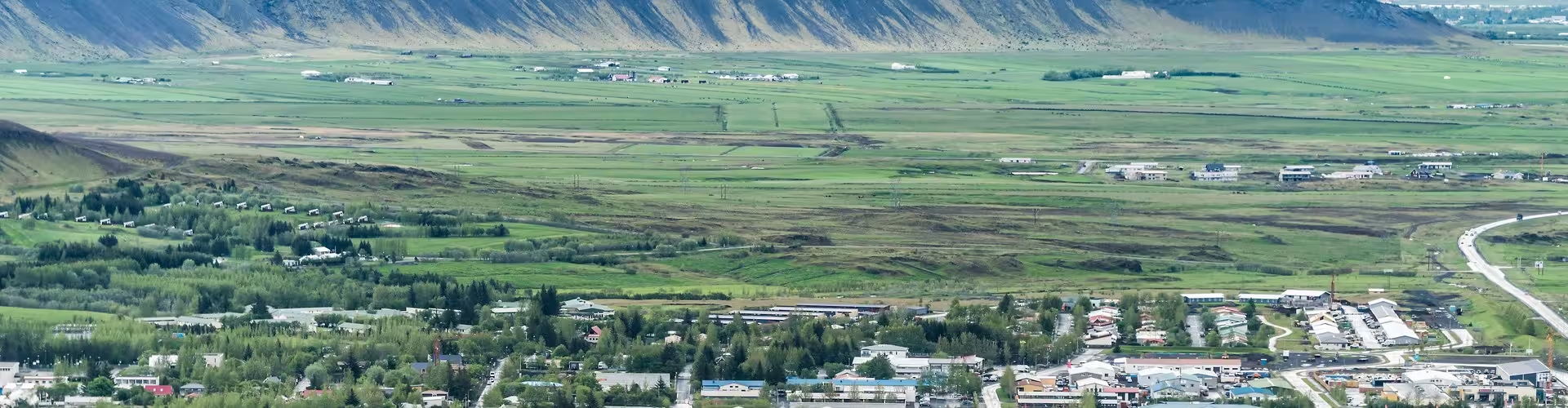
In southern Iceland, Hveragerði is both a town and a municipality on Route 1, the main ring road, 45 km east of Reykjavík. The municipality occupies 9 square kilometres. On 1 January 2024 its population was 3,265. Beneath the town lies a lava field formed 5,000 years ago.
Hot springs and greenhouses
Hveragerði occupies a broad geothermal area, with steam rising above the town at any time of year. Local heating has drawn on hot spring water since 1929. Volcanic hot springs also supply the hot water that heats the greenhouses. Since the 1920s, this energy has supported greenhouse cultivation of fruit and vegetables throughout the year.
At the Geothermal Park, guided walks take visitors around the hot springs. The park’s mud pots supply material used in natural mud baths. Rye bread baked with geothermal heat is also offered there. Baking with steam remains part of life in Hveragerði.
The town’s history and culture
The Mjólkurbú Ölfusinga dairy was established in 1928. By 1940, it was home to 121 people. Hveragerði became a separate municipality in 1946 and received town status (kaupstaður) on 1 July 1987. The town park, Lystigarðurinn Fossflöt, has welcomed visitors since 1983. Listasafn Árnesinga dates its foundation to 1963; it was based in Selfoss until it moved to Hveragerði in the early 2000s. Construction of the modern Protestant church Hveragerðiskirkja took place between 1967 and 1972.
The earthquake in southern Iceland on 29 May 2008 brought a new area of hot springs to the surface. A central Hveragerði exhibition focuses on the 2008 earthquake that affected Iceland’s South Coast.
Horse riding through the surrounding landscapes
The guided Icelandic horse tour through lava fields and farms lasts 5 hours and includes a horse suited to the rider’s level, a riding helmet, safety equipment and a local guide throughout the ride.
The guided horse riding tour in Hveragerði meadows and mountains also lasts 5 hours, with an Icelandic horse matched to the rider’s level, a helmet, safety equipment and a professional riding guide throughout.
Reykjadalur and its warm river
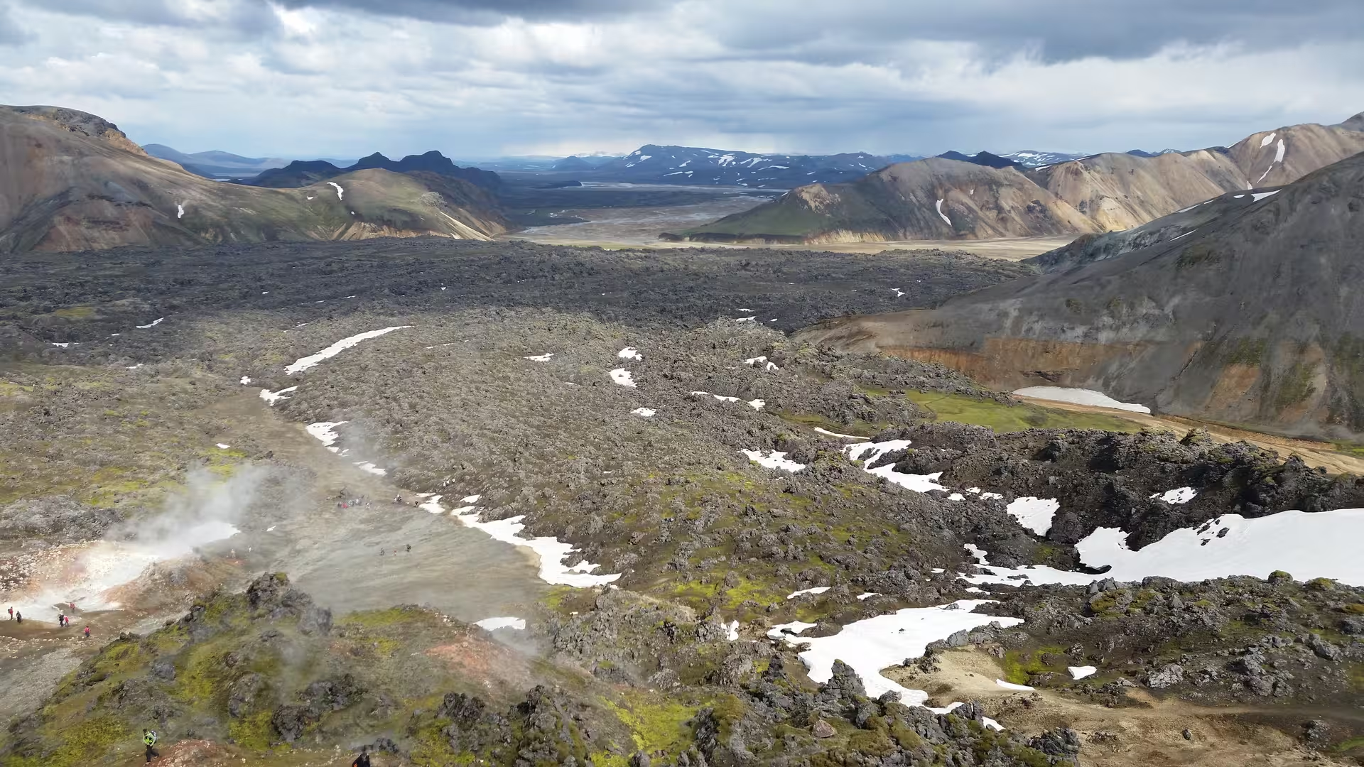
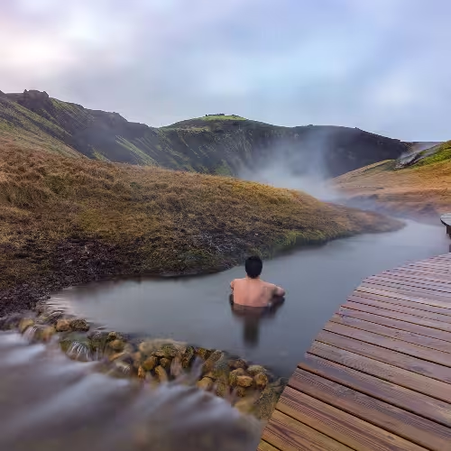
On the outskirts of Hveragerði, Reykjadalur valley lies at the foot of the Hengill volcanic mountain range in South Iceland. The trail to the river is about 3.5 km each way. Along the trail are views of canyons and waterfalls, among them Djúpagilsfoss. Wooden structures around bathing areas help protect the vulnerable landscape. Water in the river’s main bathing section is approximately 36 to 40 °C, with warmer water upstream and cooler water downstream.
A Golden Circle day trip with food tastings
The private luxury Golden Circle day trip with a gourmet experience lasts 10 hours and includes a private luxury vehicle and professional guide. Included are geothermal egg boiling and rye bread tasting in Hveragerði, skyr tasting at Skyrland and Icelandic speciality tastings at Made in Iceland. The food also includes tomato soup with homemade bread at Fridheimar, grilled leg of lamb in the Geysir area, and farm ice cream, skyr, whey and salted cheese at Efstidalur. Admission to Thingvellir National Park is included.
Frequently asked questions
Where is Hveragerði?
Hveragerði is in southern Iceland, on Route 1, 45 km east of Reykjavík.
How are the greenhouses heated?
Hot water from volcanic hot springs provides heat for the greenhouses.
How long is the walk towards the Reykjadalur river?
The trail to the river is about 3.5 km each way.
What is the water temperature in Reykjadalur?
The main bathing section is approximately 36 to 40 °C, with warmer water upstream and cooler water downstream.
What does the Golden Circle food trip include?
The 10 hour private luxury trip includes a vehicle and guide, food tastings and admission to Thingvellir National Park.