Sal: what to see and do
In the eastern part of the Cape Verde archipelago, Sal forms part of a group of three sandy islands. It is also part of the Barlavento island group. From end to end, Sal extends 29.7 km, with a width of 11.8 km.
Things to do in Sal
A full day tour of Sal with lunch and fees included lasts 7 hours. It includes a licensed professional guide, lunch and transport for the duration of the tour.
The guided sunset hike to Mount Lion on Sal lasts 4 hours. Included are a professional local guide throughout, route planning and safety oversight, and stops at Ponta Preta, Calheta and Murdeira.
Buracona and natural pools
Natural pools formed in rock occur on Sal, including Buracona towards the northern end of the west coast. Buracona is a small bay in the northwest of the island, roughly 5 km to the north of Palmeira.
The full day guided tour of Sal with natural pools and sharks lasts 6 hours. It includes an expert local guide throughout, admission to the Pedra de Lume salt pan, wading at Shark Bay, a visit to Buracona and the Blue Eye, a lunch of local Cape Verdean food and transport in a vehicle with air conditioning.
Pedra de Lume and salt production
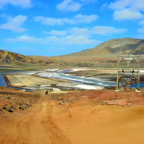
The village of Pedra de Lume is in northeastern Sal, approximately 5 km east of Espargos. Its salt pans occupy the crater of a volcano that is now extinct. Salt marshes also occur within the crater and to the north of Santa Maria.
The development of the island's salt industry began at Pedra de Lume towards the close of the eighteenth century. Production prospered through much of the nineteenth century before declining after 1887. Today, production is limited and supplies mainly beauty products and thalassotherapy.
A full day private tour of Sal with a local guide lasts 7 hours. It includes a licensed local guide for the day, lunch at a local restaurant in Palmeira, entry to the Santa Maria Salt Pans, access to the Pedra de Lume crater and lagoon, and a guided water experience at Shark Bay.
Santa Maria and the island towns
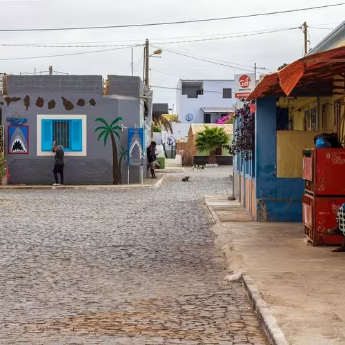
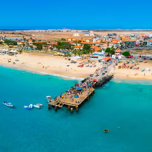
On Sal's southern coast, Santa Maria is around 16 km south of Amilcar Cabral International Airport. The settlement began in 1830 as a centre for producing salt. Tourism grew into an important island industry after 1986. Concentrated around Santa Maria, it has overtaken salt production and fishing as Sal's principal source of income.
On the western coast, the town of Palmeira stands approximately 4 km west of Espargos. Sal's principal port is located there. Espargos began developing when airport construction got under way in 1939.
Airport location
The airport is situated 2 km to the west southwest of Espargos.
Beaches and climate
Sal is a tourist destination with white sand beaches and more than 350 days of sunshine annually. Rainfall remains low during the rainy season, which extends from July to the middle of October. Santa Maria's climate is arid, with 76 mm of rain annually.
Where is Sal in Cape Verde?
Sal is among the three sandy islands in the east of the archipelago and belongs to the Barlavento group.
Where are the Pedra de Lume salt pans?
They occupy the crater of an extinct volcano at Pedra de Lume.
What is Buracona?
Buracona is a small bay in northwestern Sal, about 5 km north of Palmeira, with a natural rock pool.
Where is Santa Maria?
Santa Maria is on the south coast of Sal, approximately 16 km south of Amilcar Cabral International Airport.
What is the climate like in Santa Maria?
Santa Maria has an arid climate and receives 76 mm of rain a year.
Frequently asked questions