




Pico do Areeiro to Pico Ruivo: The Most Spectacular Hike in Madeira
Walk above the clouds on Madeira's iconic PR1 trail, connecting two of Portugal's highest peaks across volcanic ridgelines and carved stone staircases.
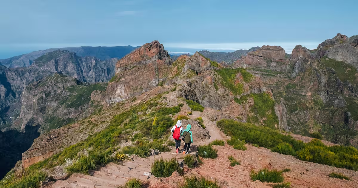
Rising to 1,862 metres above sea level, Pico Ruivo is the highest point in Madeira and the endpoint of one of the most visually dramatic mountain trails in all of Europe. The PR1 Vereda do Areeiro connects Pico do Areeiro, the island's third highest peak at 1,818 metres, to Pico Ruivo across roughly 7.5 kilometres of volcanic ridgelines, stone staircases, and short tunnels carved through the basalt. Few hikes in Portugal offer a comparable combination of altitude, scenery, and physical reward.
What Makes the Pico do Areeiro to Pico Ruivo Hike So Distinctive?
Madeira is a volcanic island of Portuguese territory sitting in the North Atlantic Ocean, approximately 978 kilometres southwest of Lisbon and 700 kilometres west of the Moroccan coast. Its central mountain spine, known as the Pico do Areeiro ridge, reaches altitudes where clouds routinely settle below the trail level, creating a phenomenon called cloud inversion. On clear mornings, hikers walk through a landscape of dark basalt pinnacles while a carpet of white cloud fills every valley beneath them, with the Atlantic Ocean glinting at the horizon.
The PR1 trail, officially designated as Vereda do Areeiro, was formally marked and maintained by the Madeira Regional Government's nature services. It is classified as a linear route, starting at Pico do Areeiro (1,818 m) and finishing at Pico Ruivo (1,862 m), though the route dips considerably between the two summits, reaching a low point near Achada do Teixeira at around 1,590 metres. The cumulative elevation gain walking from Areeiro to Ruivo is approximately 780 metres when accounting for descents and re-ascents along the undulating ridge.
"The trail does not simply connect two peaks. It traverses a geological timeline of volcanic Madeira, crossing lava formations, basalt columns, and erosion channels that took millions of years to shape into their current dramatic form."
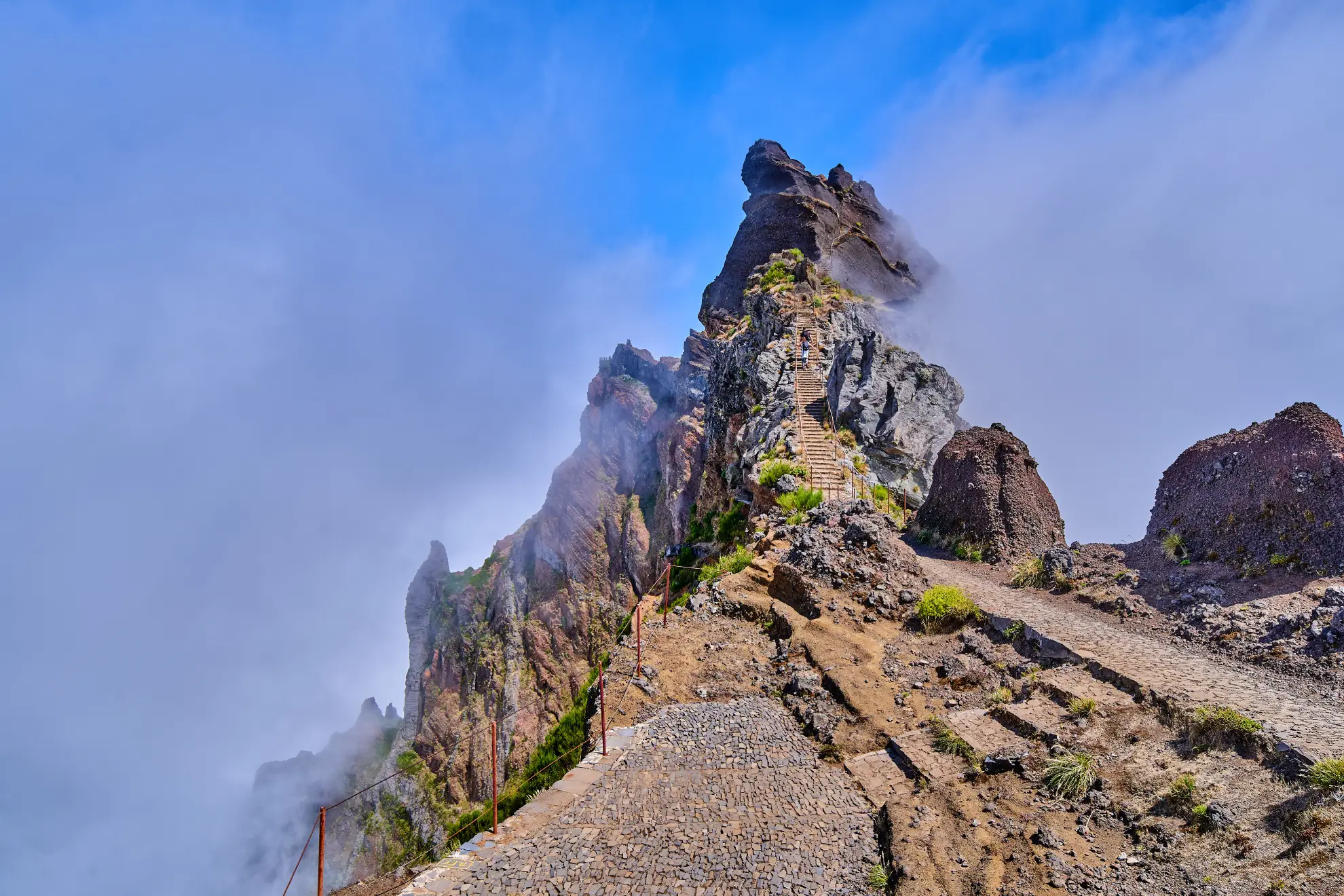
The route passes through several key landmarks including Ninho da Manta viewpoint, the Torres rock formations, and the distinctive stone shelters built along the ridge. Two tunnels, each roughly 100 metres in length, cut directly through rock faces where the path cannot safely follow the cliff edge. Inside, the temperature drops noticeably and a headlamp or torch becomes genuinely useful rather than optional.
How Difficult Is the Pico Ruivo Hike and Who Can Do It?
The PR1 trail covers approximately 7.5 kilometres one way, with a total round trip of 15 kilometres if hikers return to Pico do Areeiro on the same path. The trail authority rates it as medium to difficult, primarily because of the cumulative elevation changes rather than any single extreme section. Most hikers in reasonable physical condition complete the one-way traverse in 3 to 4 hours, not including stops for photographs or rest.
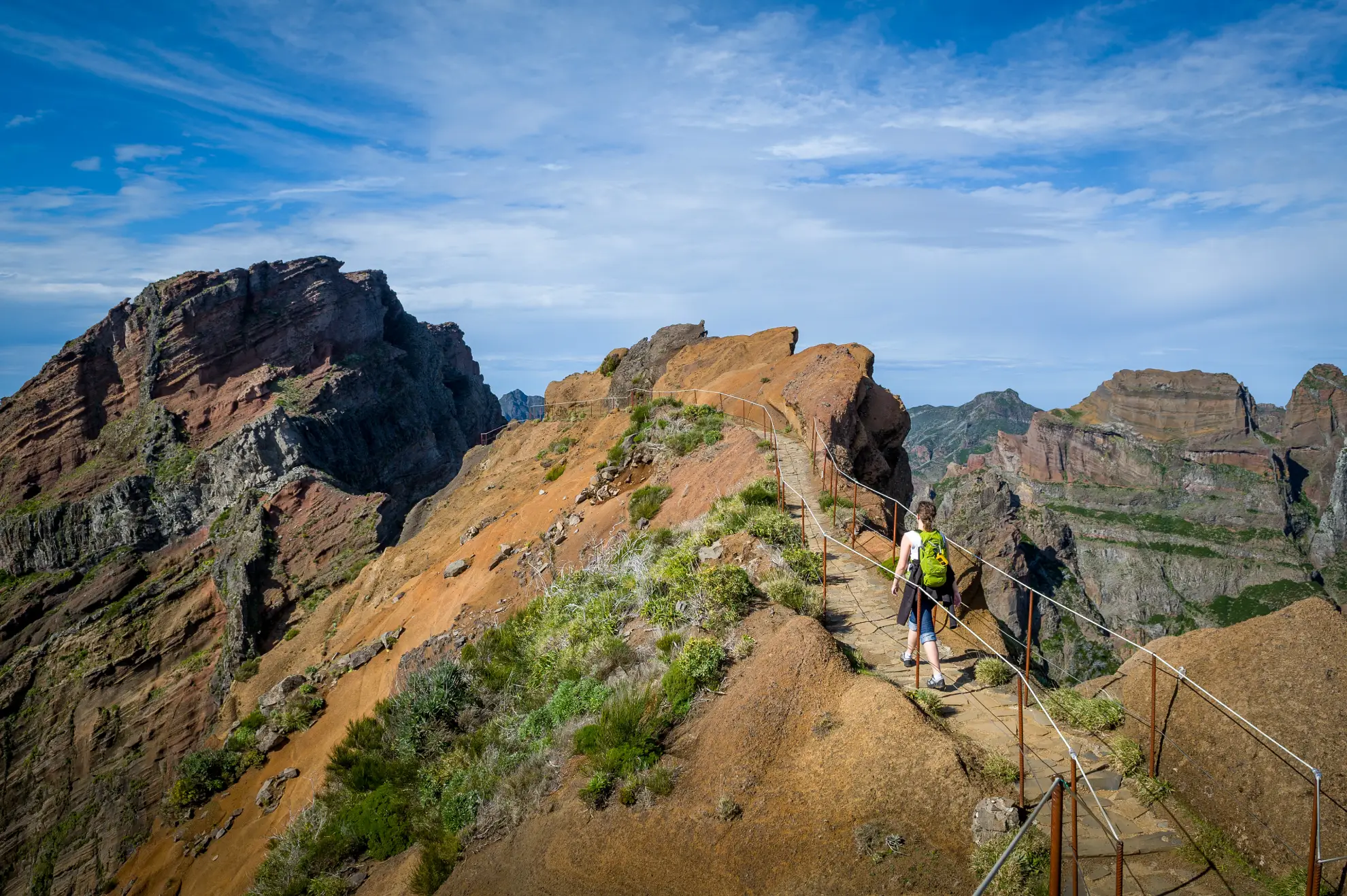
The path is well-maintained with stone steps, metal handrails on exposed sections, and clear trail markers throughout. However, some passages involve narrow ledges above steep drops and require confident footing. The trail surface alternates between cut stone staircases, compacted earth, and loose gravel on steeper descents. Wet conditions make certain sections significantly more demanding, as the basalt rock becomes slippery when damp.
Beginners can complete the hike provided they are prepared physically and mentally for sustained ascents. The recommended minimum age for children is around 10 to 12 years, depending on fitness level and experience. The trail is not suitable for wheeled mobility aids or pushchairs. Hikers who prefer a shorter option can access Pico Ruivo directly from Achada do Teixeira via a 1.5-kilometre path with a relatively modest elevation gain of approximately 220 metres.
"The difference between the Achada do Teixeira shortcut and the full PR1 traverse is the difference between visiting a mountain and experiencing it. The longer route earns the view."
Trail conditions are monitored by the Instituto das Florestas e Conservação da Natureza (IFCN), Madeira's regional forestry and nature conservation authority. Closures due to storm damage, high winds, or fire risk are announced on their official website. Checking for trail status updates before departure is strongly recommended, particularly between October and March when Atlantic weather systems move through the island unpredictably.
What Is the Best Time to Hike Pico do Areeiro to Pico Ruivo?
The months of May through September offer the most reliable conditions for clear skies and stable weather on the central ridge. During these months, the Azores High pressure system typically keeps the north-facing slopes cloudy while the southern flanks enjoy sunshine, and the summit area often sits above the cloud layer by mid-morning. Temperatures at altitude range from approximately 8°C to 18°C during summer months, making layers essential regardless of conditions at sea level.
Sunrise hikes starting from Pico do Areeiro are a popular choice year-round. Pico do Areeiro is accessible by road, with a large car park at the summit. The road, designated ER202, connects the peak to Funchal, approximately 29 kilometres to the southwest. Many hikers drive up before dawn to watch the sunrise from the Areeiro viewpoint before beginning the trail, which places them on the exposed ridge during the most photogenic morning light. Sunrise times vary from approximately 06:00 in June to 07:30 in December.
Cloud inversion events, where cloud fills the valleys while the peaks remain clear, occur most frequently in autumn and winter mornings, typically between October and February. These conditions produce the most visually striking scenery on the trail but require careful weather monitoring, as conditions can deteriorate rapidly. Summer weekends see the highest foot traffic, with queues forming at narrow sections during peak morning hours between 08:00 and 11:00.
For photographers, the golden hour window immediately after sunrise offers directional light that emphasises the texture of the volcanic rock and the depth of the valley shadows. The Ninho da Manta viewpoint at approximately kilometre 2.5 of the trail provides an unobstructed east-facing perspective that captures both the ridge silhouette and the cloud layer below simultaneously.
What Should You Bring on the PR1 Trail?
Footwear is the single most important preparation decision. Trail running shoes with good grip are acceptable in dry summer conditions, but hiking boots with ankle support are recommended for the full PR1 traverse, particularly in shoulder seasons. The stone staircases place repeated impact stress on the ankles and knees, and grip on wet basalt is critical for safety on the descent sections.
A standard day pack should include a minimum of 1.5 litres of water per person, as there are no reliable water sources on the trail between Pico do Areeiro and Pico Ruivo. Energy snacks, a wind-proof jacket, and a thin fleece layer are essential. The temperature differential between Funchal (typically 20°C to 25°C in summer) and the summit (8°C to 14°C with wind chill) regularly catches unprepared visitors off guard.
A headlamp or compact torch is needed for the two trail tunnels, both of which are unlit. Sunscreen and sunglasses are important above the cloud layer, where UV exposure is significantly higher than at sea level. Trekking poles reduce knee strain considerably on the descent sections and are widely used by experienced hikers on this route.
There is a small staffed shelter and basic café at Pico Ruivo, operated seasonally, where hikers can purchase water, hot drinks, and simple food. Opening hours are not guaranteed out of peak season, so relying on it for essential supplies is not advised. The car park at Pico do Areeiro has restroom facilities and a small café that opens in the morning to serve early hikers.
Explore Madeira's Best Adventure Tours
Ready to hike above the clouds in Madeira? Browse guided hiking and adventure tours on ToursXplorer and find the right experience for your fitness level and travel dates.
Click herePlanning Your Pico do Areeiro to Pico Ruivo Hike: Key Logistics
The most common logistics approach is to arrange a car drop at Pico do Areeiro and a pick-up at Achada do Teixeira, the nearest road access point to Pico Ruivo, approximately 1.5 kilometres below the summit. Achada do Teixeira is reached via the village of Santana on the north coast, following regional road ER101 and then ER218. Taxi services from Funchal or pre-arranged transfers with local operators are the standard solution for hikers without two vehicles.
Alternatively, some hikers complete the traverse in reverse, starting at Achada do Teixeira, summiting Pico Ruivo, and continuing to Pico do Areeiro, before returning to their vehicle by taxi or shuttle. A smaller number of physically fit hikers complete the full return traverse, covering approximately 15 kilometres with around 1,400 metres of cumulative elevation change round trip, typically in 6 to 8 hours.
ToursXplorer lists a range of guided walking tours and self-guided experiences that include transport logistics as part of the package, removing the complexity of coordinating private vehicles across two mountain road termini. Guided options also include naturalist commentary on the endemic flora of the central massif, which includes Echium candicans (Pride of Madeira), Argyranthemum species, and the ancient Laurus azorica laurel forest at lower elevations.
Parking at Pico do Areeiro is free and operates on a first-come basis. On summer weekends and public holidays, the car park fills by 07:30. The nearest fuel station is in Poiso, approximately 7 kilometres from the peak on ER103, which is also the junction road connecting the Areeiro access road to the north coast.
Is the Pico do Areeiro to Pico Ruivo Hike Worth It?
The honest answer depends on what a visitor is looking for. For those who want a physically engaging day in the mountains with sustained panoramic views and a clear sense of achievement, the PR1 Vereda do Areeiro consistently delivers. The combination of volcanic geology, frequent cloud inversion events, high-altitude endemic plant communities, and well-engineered trail infrastructure makes it a genuinely distinctive experience rather than a generic mountain walk.
The trail's reputation as one of Europe's great mountain day hikes is supported by its placement on multiple European hiking registries and its consistent appearance in Portuguese national tourism campaigns since the 1990s. The route is not a wilderness experience in the strict sense. The path is well-marked, the infrastructure is maintained, and the summit at Pico Ruivo has visitor facilities. But the geological drama of the central Madeiran ridge is real and not overstated by the trail's reputation.
Visitors who have only a single day allocated for outdoor activity in Madeira consistently rank the Pico do Areeiro to Pico Ruivo traverse as the highest-value use of that day. ToursXplorer's curated selection of Madeira adventure and hiking experiences includes options for all fitness levels, from the full PR1 traverse to shorter guided walks that access the same volcanic landscapes with less physical commitment.
Frequently Asked Questions
The one-way distance from Pico do Areeiro to Pico Ruivo along the PR1 Vereda do Areeiro trail is approximately 7.5 kilometres. Most hikers complete the traverse in 3 to 4 hours, not including rest stops. A round trip on the same path covers roughly 15 kilometres and typically takes 6 to 8 hours total.
The PR1 trail is rated medium to difficult by Madeira's trail authority. Beginners in reasonable physical condition can complete it, but should be comfortable with sustained ascents, narrow ledges, and stone staircases. Wet conditions significantly increase difficulty. The shorter route from Achada do Teixeira to Pico Ruivo, just 1.5 kilometres one way, is a more accessible alternative for less experienced walkers.
Starting before sunrise, typically between 05:30 and 06:30 depending on the season, places hikers on the ridge during the most atmospheric morning light. May through September offer the most stable weather. Cloud inversions are most common in autumn and winter mornings. Summer weekends see peak crowds on the trail between 08:00 and 11:00, so early starts also help avoid congestion at narrow sections.
Bring hiking boots with ankle support, at least 1.5 litres of water per person, energy snacks, a windproof jacket, a fleece layer, and a headlamp for the two unlit tunnels on the route. Sunscreen and sunglasses are important above the cloud layer. There is a seasonal café at Pico Ruivo, but it cannot be relied upon for essential supplies outside peak season.
Yes. On clear days, the Atlantic Ocean is visible in multiple directions from the Pico Ruivo summit at 1,862 metres. The surrounding islands of Porto Santo, approximately 43 kilometres to the northeast, and occasionally the Desertas Islands, around 26 kilometres to the southeast, are also visible from the summit and from exposed sections of the PR1 ridge.
The PR1 Vereda do Areeiro is generally open year-round, but partial or full closures occur due to storm damage, high winds, or fire risk, particularly between October and March. Closure notices are published by the Instituto das Florestas e Conservação da Natureza (IFCN), Madeira's regional nature conservation authority. Checking their official website before departure is strongly recommended during the autumn and winter months.