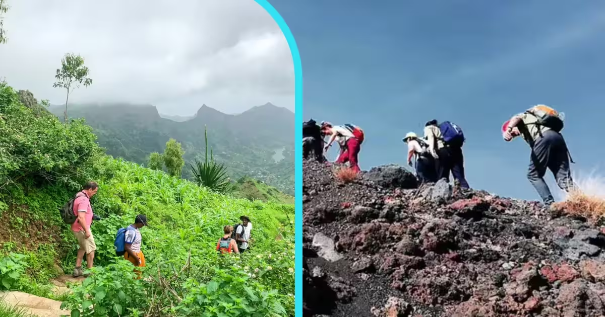
One is a misty cloud-forest reserve at 850 metres on Santiago Island — green, lush, and alive with endemic birds. The other is an active volcano summit at 2,829 metres on a completely different island — bare rock, lava ash, and the rooftop of Cape Verde. Both are extraordinary. Here is how to decide which hike is yours.
Cape Verde does not do things in half measures. Its hiking trails are on different islands — geologically distinct, logistically separate, and almost entirely different in what they ask of you. Serra Malagueta is a protected natural park on Santiago Island, accessible by road from the capital, rated easy, and celebrated as much for the family lunch at the bottom of the trail as for the views from the top. Pico do Fogo is a 2,829-metre active volcano on a different island entirely, accessed by inter-island flight, rated challenging, and capable of stopping unprepared hikers well before the crater rim. Comparing them directly is almost absurd — and yet that is exactly the decision every hiker in Cape Verde eventually faces. This guide makes it easier.
The title calls both trails “volcano trails,” and while Pico do Fogo is self-evidently volcanic — an active stratovolcano that last erupted in 2014 and buried an entire village under lava — Serra Malagueta is something more subtle: a highland nature reserve perched on the volcanic spine of Santiago Island, where cloud and mist roll through a forest of endemic plants above fertile agricultural valleys. The volcanic origins are there in the rock and soil, but the experience is green, living, and layered with human culture rather than geological drama. Understanding this difference is the first step to knowing which trail belongs on your itinerary.
Both hikes are available as guided day tours. Both are genuinely among the best outdoor experiences in the Cape Verde archipelago. But they are for different people, on different days, in different physical and logistical conditions. Read on.
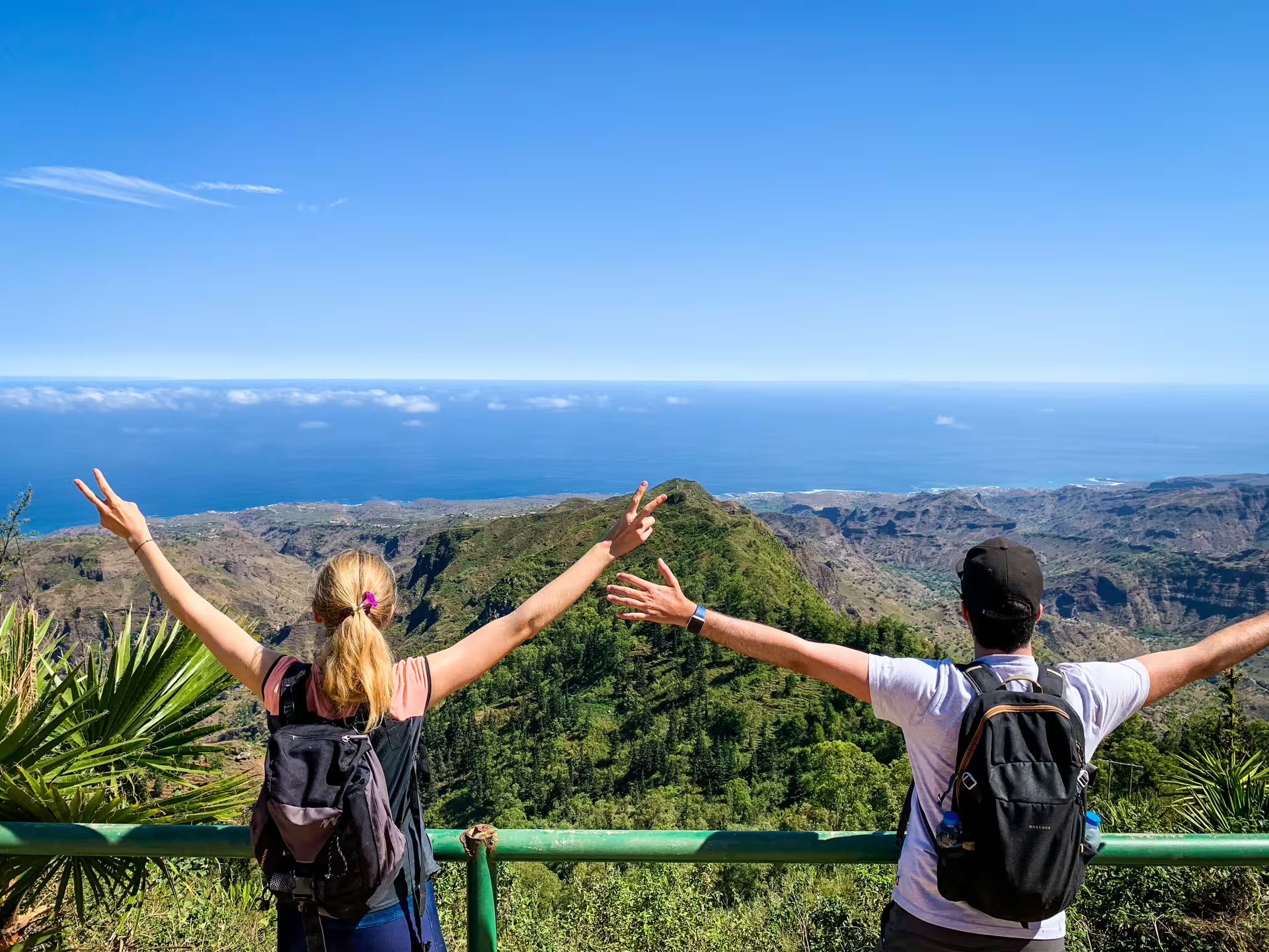
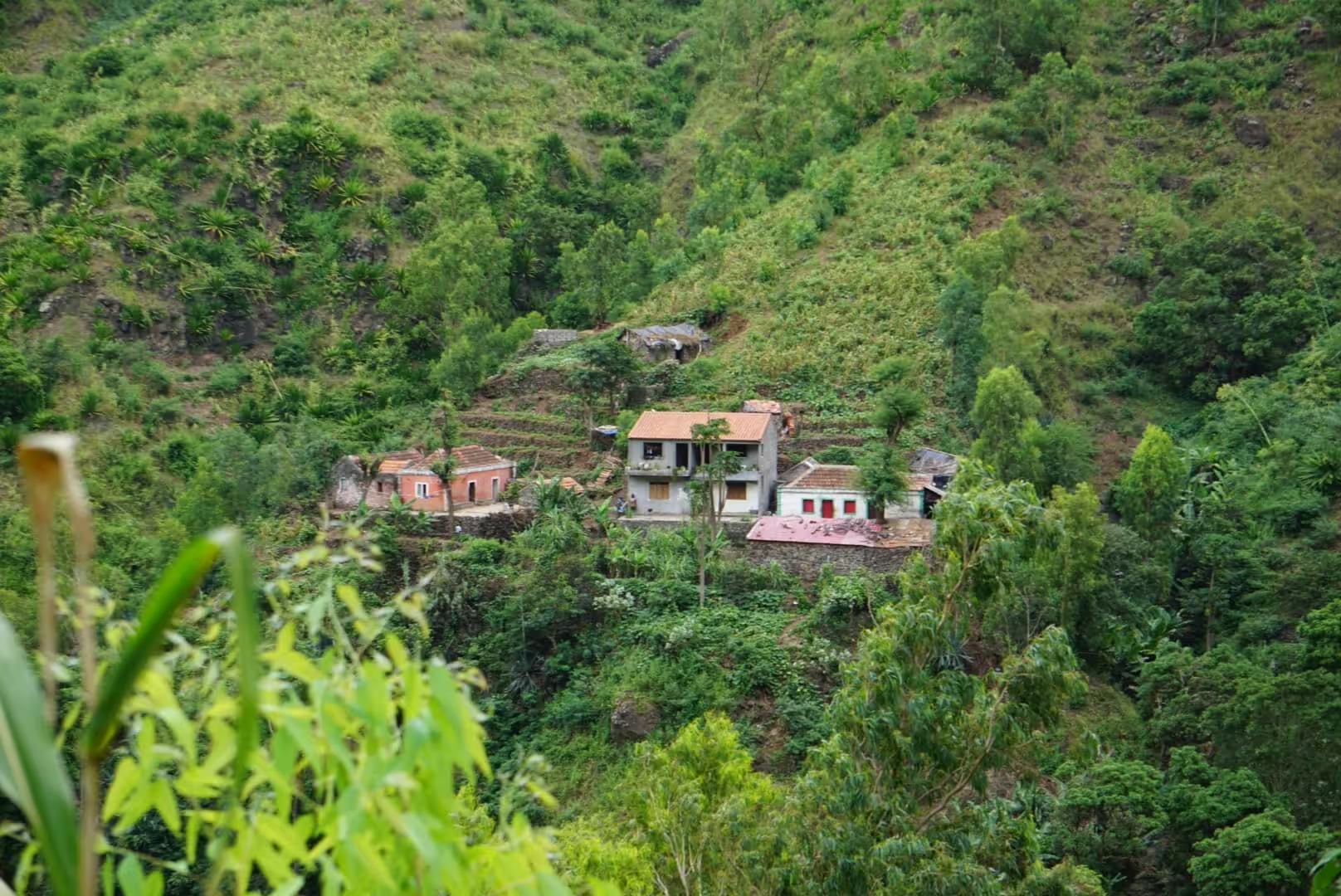
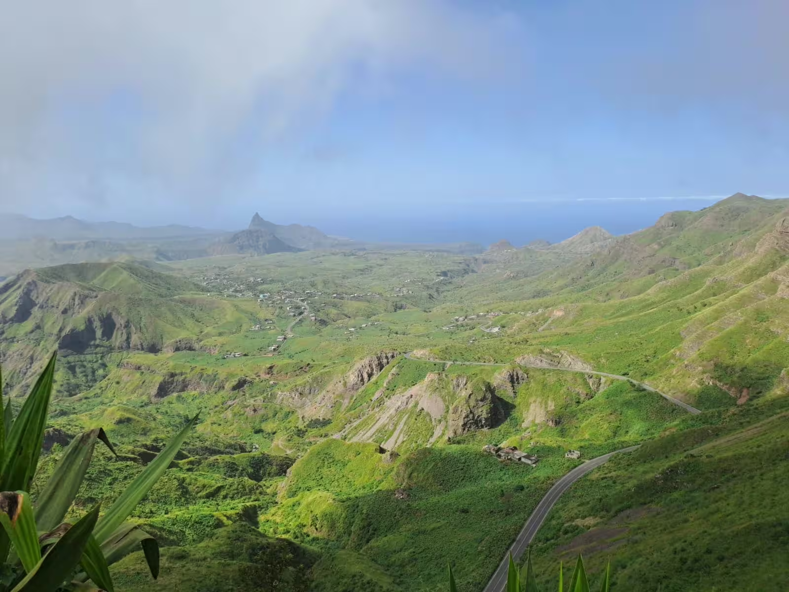
Serra Malagueta is one of Cape Verde’s best-kept hiking secrets. Sitting at around 850 to 1,000 metres above sea level in the mountainous interior of Santiago Island, it is a protected nature reserve of 774 hectares where cloud and mist drift through a forest of over 124 endemic plant species, and 19 bird species found nowhere else on the island go about their business in the canopy. On a clear morning, standing at the trailhead, you can look across the ridgelines and understand immediately why the Portuguese settlers who colonised this island five centuries ago chose the interior valleys as their most productive agricultural land.
The principal hiking route descends from the highland reserve through the Principal Valley — a living landscape of coconut palms, banana groves, tamarind trees, sugar cane, and mango plots that supply local households and markets across the island. The trail is not a wilderness track in the classic sense: it passes through active communities, past stone farmhouses built into the canyon walls, alongside terraced fields that have been cultivated for generations. Your guide explains what is growing, who tends it, and what it means to the people who live here. This is not a nature walk where you observe from a distance. It is a walk through someone’s neighbourhood.
The trail ends in Mato Dento, where the experience shifts from walking to sitting: a home-cooked lunch with a local family, prepared from produce grown in or near the valley, served with fresh fruit juices and the kind of hospitality that Cape Verdeans call Morabeza — a word that means something between warmth, generosity, and genuine welcome. This is not a restaurant meal pretending to be local. It is the real thing, in a real home, with people who are genuinely pleased to have you there.
Serra Malagueta suits a wide range of hikers — including those who would not normally describe themselves as hikers at all. The difficulty is moderate, the terrain is natural rather than technical, and the payoff is cultural and sensory rather than purely physical. If you are based in Praia and want the most rounded single-day outdoor experience on Santiago Island — combining ecological richness, highland scenery, cultural depth, and the option of ending at Tarrafal Beach — Serra Malagueta is the clear answer.
✓ Accessible from Praia by road — no inter-island flight required
✓ Easy to moderate difficulty — suitable for most fitness levels
✓ 124 endemic plant species and 19 bird species in a protected reserve
✓ Authentic cultural immersion with a local family lunch (Morabeza)
✓ Stunning valley panoramas without extreme altitude or technical terrain
✓ Easily combined with Tarrafal Beach for a full mountain-to-sea day
✓ Hotel pickup and drop-off included in most tours
✗ No summit experience — the trail does not reach a dramatic peak
✗ Views are green and expansive but not the awe-inspiring “above the clouds” panorama of Pico do Fogo
✗ Assomada Market visit only possible on Wednesdays and Saturdays
✗ Trail surface can be slippery after rain
✗ Not the choice for those seeking a physical challenge or altitude record
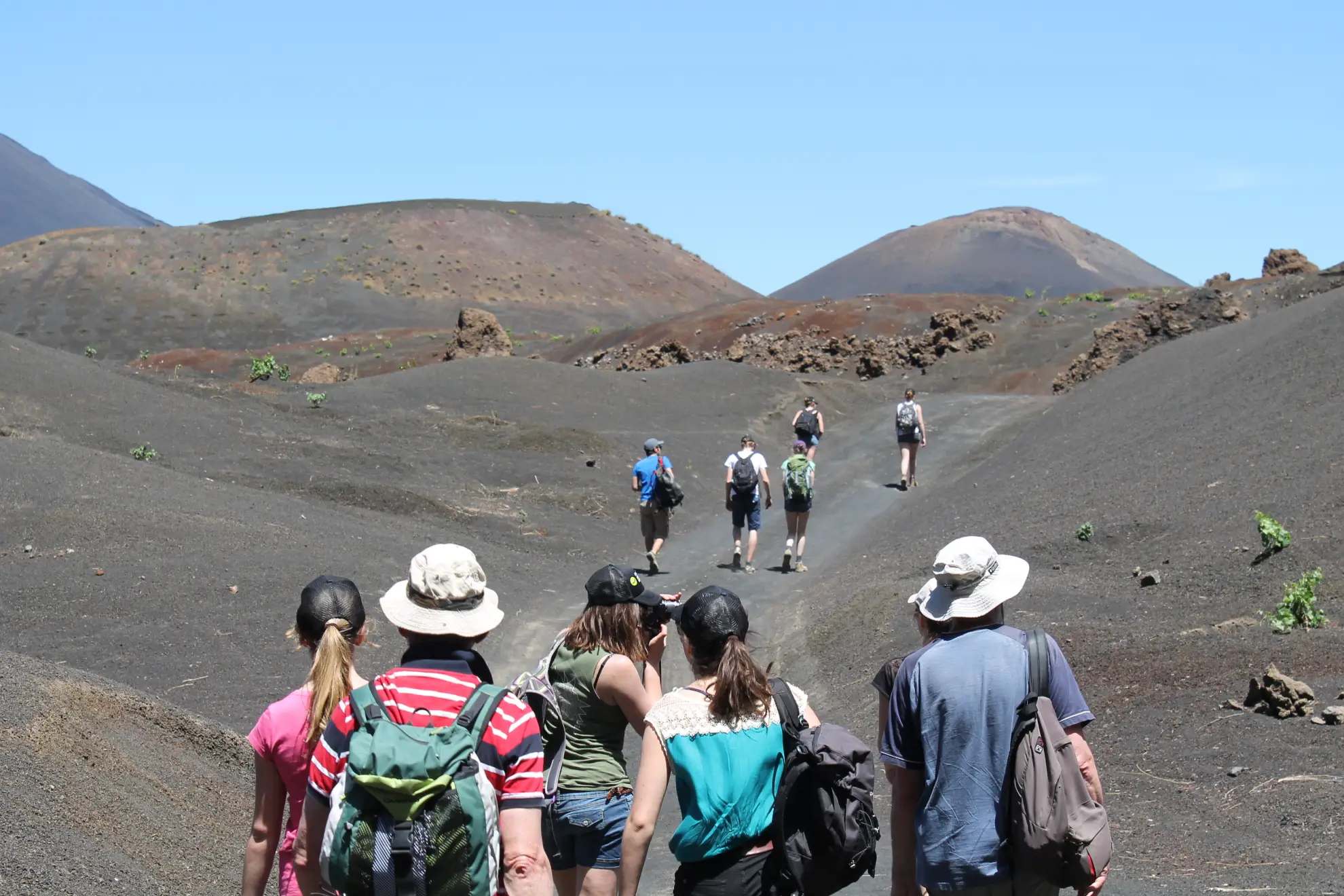
Pico do Fogo is not a mountain you approach casually. It is an active stratovolcano — the third-highest peak in the Atlantic Ocean — that last erupted in 2014 and covered an entire caldera village under lava flows that took two years to cool. The people of Chã das Caldeiras, who live inside the main volcanic caldera at 1,730 metres, grow wine grapes and fruit trees in the nutrient-rich volcanic soil between two craters. When you stand at the base of Pico do Fogo and look up at the cone rising above you, the scale of what you are about to climb becomes immediately and humblingly apparent.
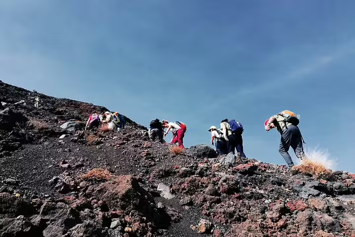
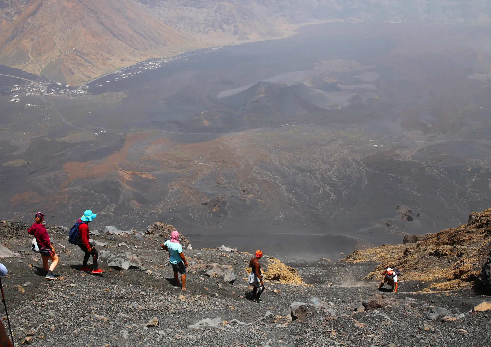
The ascent begins in Chã das Caldeiras, passing through the agricultural terraces of the caldera — fig trees, vineyards, apple and pear trees growing in soil that has been rearranged by multiple eruptions. As you climb beyond the cultivated zone, the landscape transitions sharply: vegetation gives way to bare volcanic rock, then to fields of hardened lava from the 2014 flow, then to steep scree of loose cinder and ash that characterises the upper cone. The gradient increases with every hundred metres of altitude, and by the time you are approaching the crater rim, you are moving through terrain that has the texture and appearance of another planet.
The summit at 2,829 metres is genuinely spectacular. A full 360-degree panorama opens up over Fogo Island, the Atlantic, and — on clear days — to neighbouring islands. The sensation of standing above the clouds in the middle of the ocean, on the edge of an active crater, is one that is difficult to replicate anywhere in the Atlantic world. The picnic at the top is part of the experience, a brief moment of stillness in the wind before the descent.
And the descent is extraordinary in its own right. Rather than retracing the rocky path upward, you descend through loose volcanic ash in a running-sliding style that is unique to active volcanic terrain. You can move fifty metres in seconds. What took four hours to climb takes a fraction of the time to come down, and most participants cite the ash descent as the most purely fun part of the entire day. It is not subtle — you arrive at the bottom of the cone covered in grey ash and grinning.
Getting to Pico do Fogo requires a short inter-island flight from Praia to São Filipe on Fogo Island. This is not a day trip from Santiago — or rather, it can be, but staying at least one night in Chã das Caldeiras and allowing time to understand the caldera before the hike transforms the whole experience. The flight takes 30 to 40 minutes and operates regularly. It is worth every minute of the planning.
✓ Summit of Cape Verde’s highest and only active volcano — a genuine bucket-list experience
✓ 360° panoramic views above the clouds, potentially extending to neighbouring islands
✓ Thrilling volcanic ash descent — unique to active volcanic terrain
✓ The caldera village of Chã das Caldeiras is one of the most extraordinary inhabited landscapes in Africa
✓ Post-2014 lava fields add raw, recent geological drama to the trail
✓ Expert local guides with intimate knowledge of the volcano’s geology and eruption history
✓ Most inclusive tour (€27) includes transfers from São Filipe and summit picnic
✗ Requires a separate inter-island flight to Fogo — adds cost and planning
✗ Rated challenging — not suitable for inexperienced hikers or those with limited fitness
✗ Altitude can cause mild symptoms (headaches, dizziness) even below 3,000 m
✗ Weather and volcanic conditions can cause cancellation — plans must be flexible
✗ Limited infrastructure on the summit — no shelter, exposed to wind and rapid weather changes
✗ Recommended minimum age of 16; not suitable for younger children or guests with joint issues
→ You are based on Santiago Island and want a full day out without catching a flight
→ You enjoy nature, ecology, and endemic species as much as (or more than) physical achievement
→ You want a genuine cultural encounter — not just a landscape, but a people
→ You are hiking with a partner, family member, or friend of mixed fitness levels
→ You want to combine a hike with Tarrafal Beach in a single day
→ You are a first-time visitor to Cape Verde who wants a representative cross-section of the island’s character
→ You prefer a moderate, sustainable pace over a maximum physical challenge
→ Summiting an active volcano is on your bucket list and you are willing to make it happen
→ You are fit, experienced, and genuinely comfortable with multi-hour strenuous climbs
→ You want the most dramatic and visually extraordinary outdoor experience in Cape Verde
→ You are already planning to visit Fogo Island for its caldera village, local wine, and unique landscape
→ You want a hike that you will be talking about years later
→ You are an experienced hiker who finds easy trails unsatisfying
→ You are flexible enough to reschedule if weather or volcanic conditions require it
For most visitors to Cape Verde, Serra Malagueta is the better starting point: accessible, ecologically rich, culturally immersive, and genuinely rewarding without demanding exceptional fitness or island-hopping logistics. For serious hikers with a few extra days and a higher threshold for physical effort, Pico do Fogo is in a completely different league — one of the finest volcanic hiking experiences in the Atlantic world, full stop. If your itinerary allows it, do both. The contrast alone — lush green cloud forest on Santiago one day, bare volcanic cone on Fogo the next — is one of the most striking things Cape Verde can offer an outdoor traveller.
Pico do Fogo requires a flight from Praia (Nelson Mandela International Airport, RAI) to São Filipe Airport on Fogo Island. Cabo Verde Airlines (TACV) operates this route regularly; the flight takes approximately 30 to 40 minutes. Plan for at least one overnight stay on Fogo Island before the hike. Staying in Chã das Caldeiras itself — inside the caldera at 1,730 metres — is the most immersive option and gives you an early start on the trail.
For Serra Malagueta, sturdy closed-toe walking shoes, a hat, sunscreen, and a light layer for the highland start are the essentials. A refillable water bottle, a small daypack, and comfortable breathable clothing complete the kit. For Pico do Fogo, the requirements are significantly more serious: proper hiking boots with ankle support, wind-resistant and warm layered clothing for summit temperatures (which can be 10–15°C cooler than at sea level), sunscreen, sunglasses, trekking poles, and a minimum of two litres of water per person. Gaiters to keep volcanic ash out of your shoes during the descent are a worthwhile addition.
Both hikes start early. For Serra Malagueta, morning departures from Praia take advantage of cooler temperatures in the highland reserve before the midday heat builds. For Pico do Fogo, an early start from Chã das Caldeiras (typically around 07:00–08:00) is essential to reach the summit before afternoon cloud and wind build around the crater rim. Guides on both trails are experienced at reading conditions and will advise on timing when you book.
Pico do Fogo hikes can be cancelled due to adverse weather or volcanic activity. If you are planning your trip around the summit, build in a spare day on Fogo Island so that a postponement does not mean a missed opportunity. Serra Malagueta tours operate rain or shine, though trail surfaces can be slippery after rain and the valley floor can be wet underfoot in the wet season.
Whether you are heading for the green valleys of Santiago or the volcanic cone of Fogo, these four tours cover the full range — from an easy highland hike with a family lunch to a serious multi-hour summit climb above the clouds.
Browse the full range of guided hikes across Cape Verde — from cloud-forest walks on Santiago Island to volcano summits on Fogo — with instant availability and real-time booking.
See All Cape Verde Hiking Tours →