Laki Craters Airplane Tour from Skaftafell
A 50-minute flight over one of Iceland's most dramatic volcanic landscapes
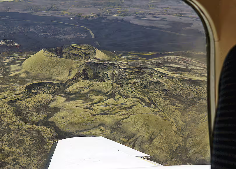
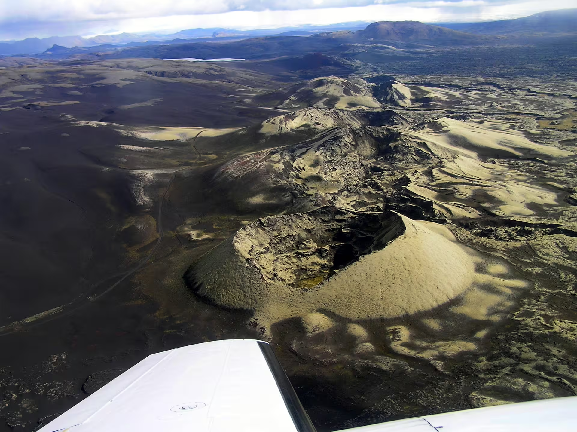
This aerial tour gives you a rare perspective on the Laki crater chain, a 25-kilometer volcanic fissure system formed during the catastrophic 1783 eruption that reshaped Iceland's highlands. Departing from Skaftafell Terminal, the flight routes through glacier terrain and remote highland scenery before reaching the Lakagígar crater row.
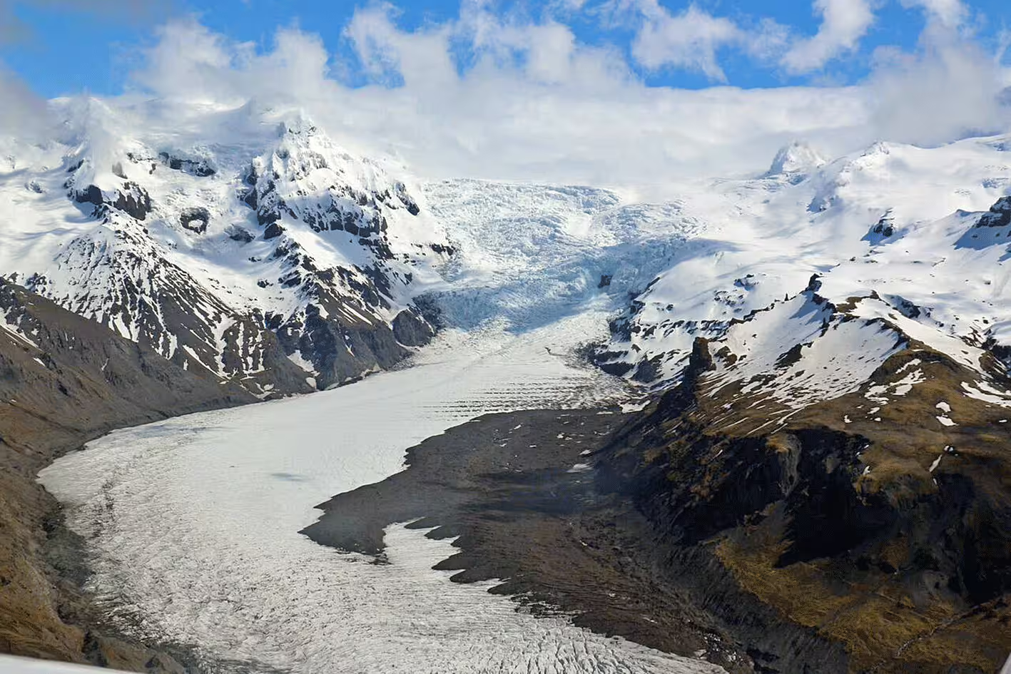
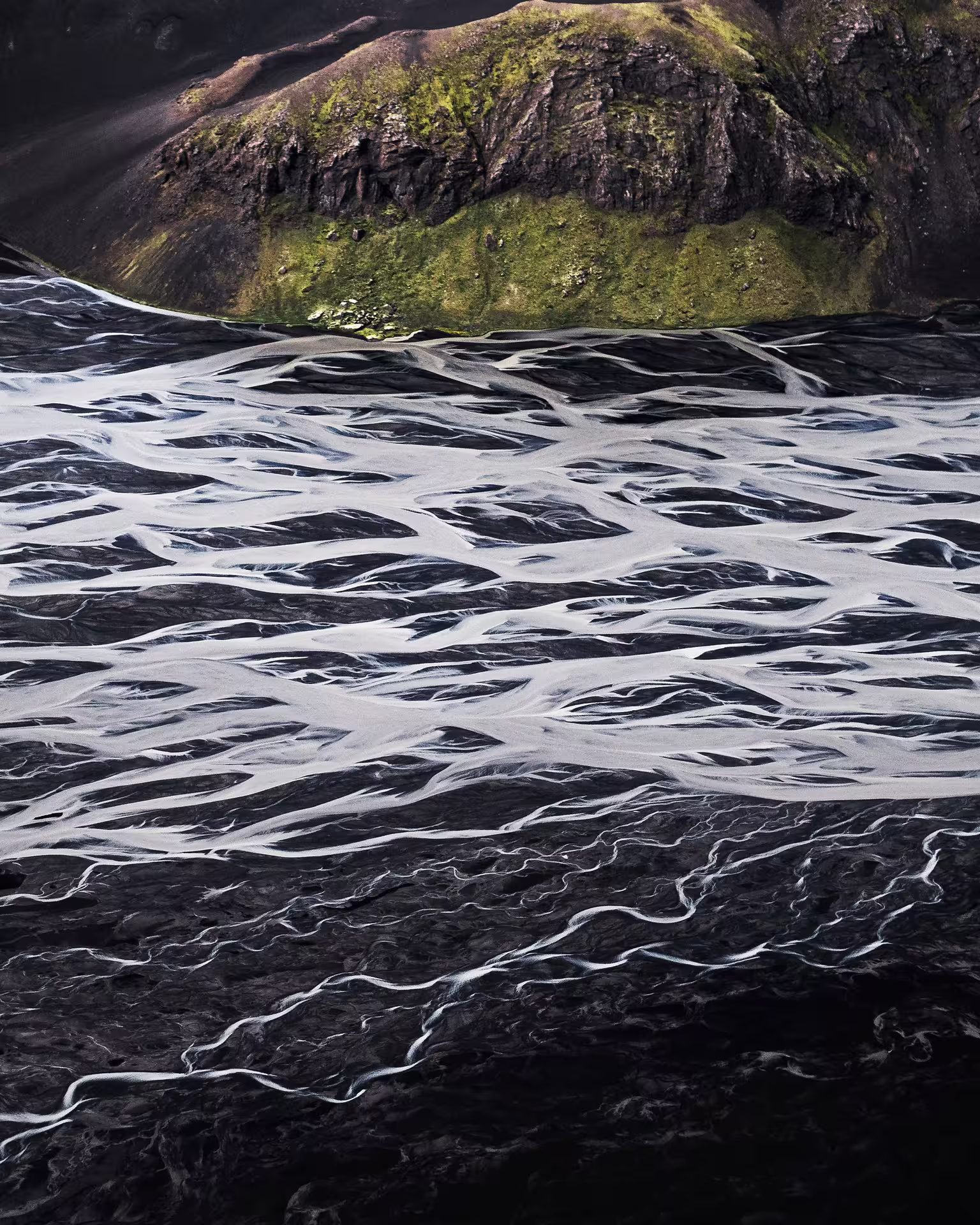
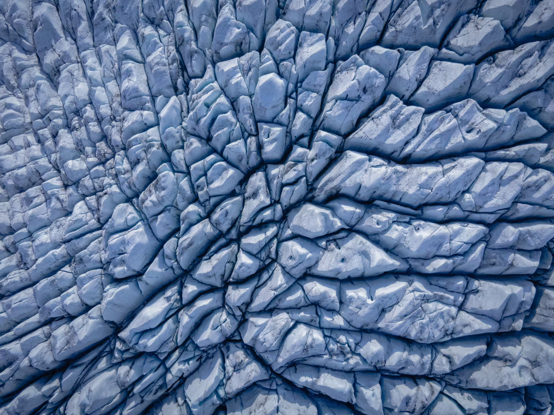
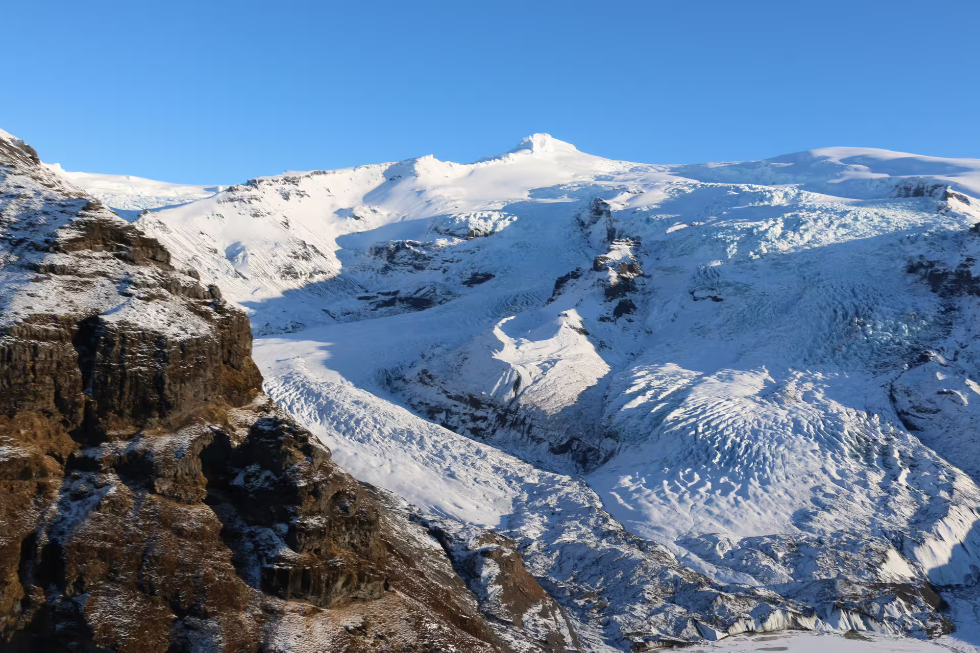
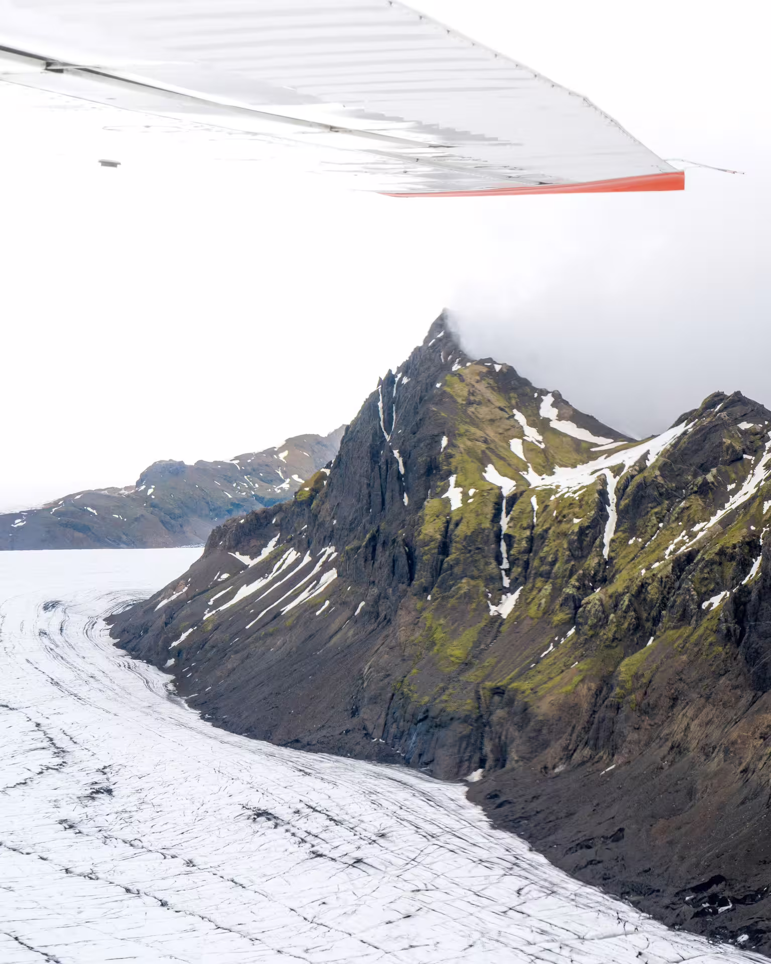
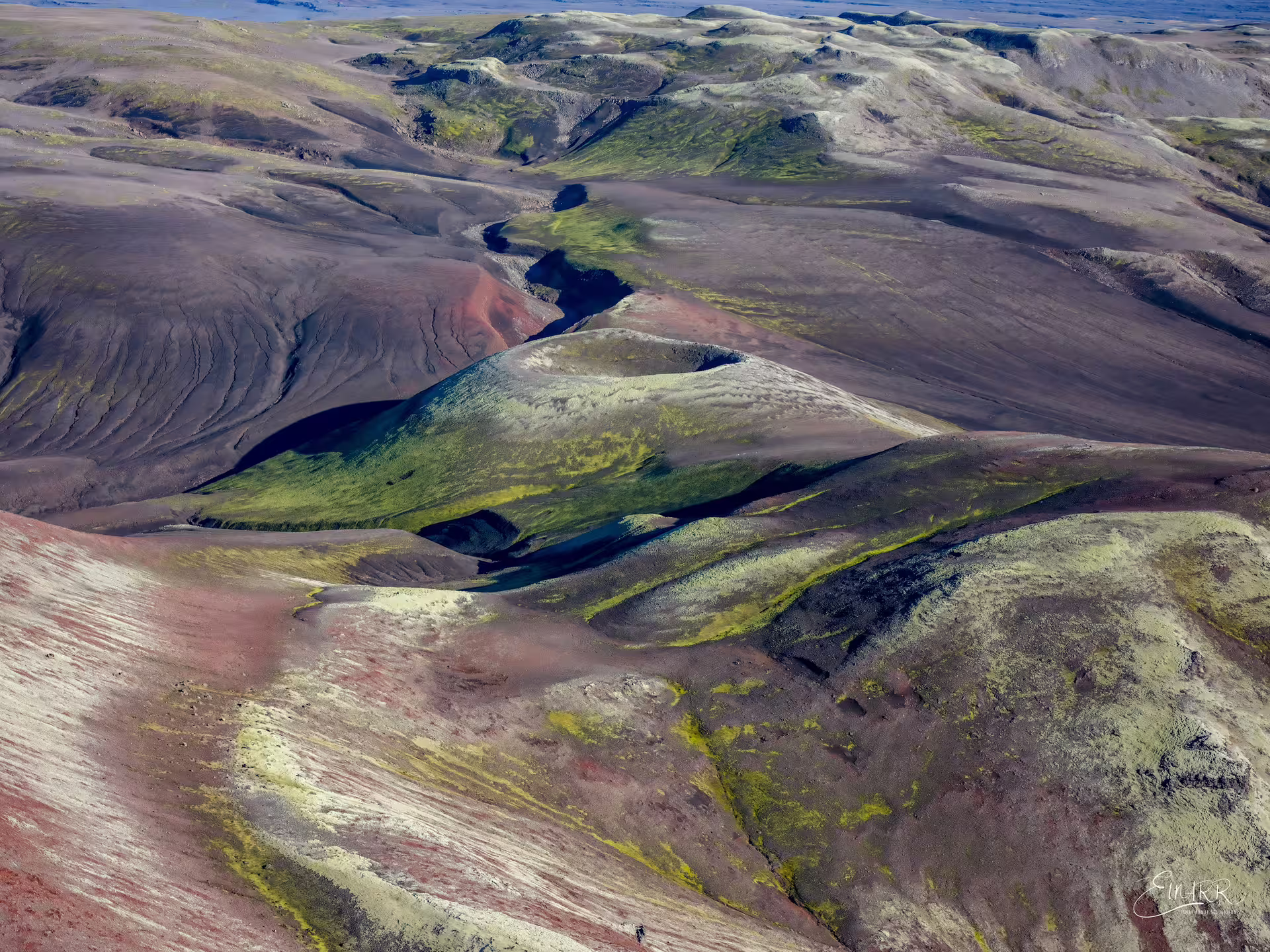
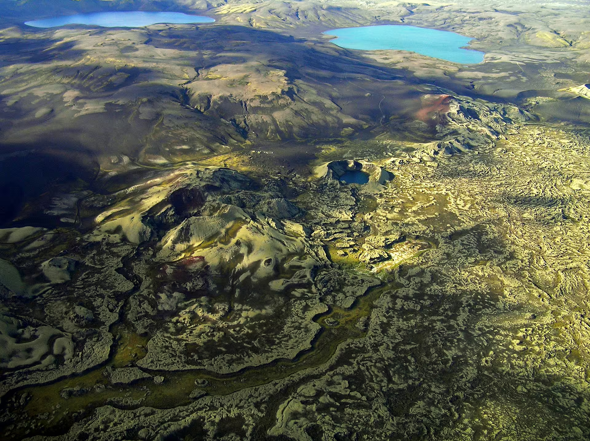
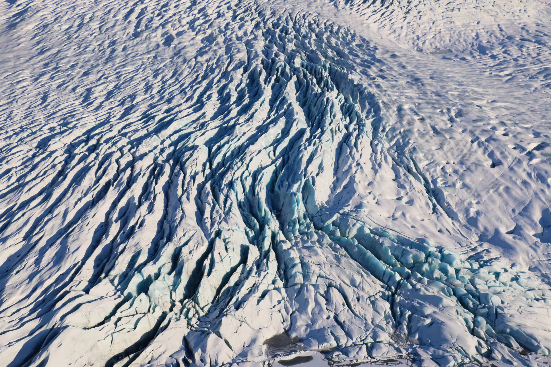
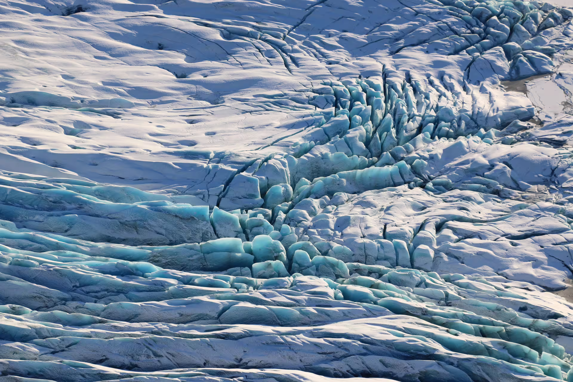
The route takes you over the southern outlet glaciers of Vatnajökull before transitioning into the vast, moss-draped lava fields that surround the Laki formation. From altitude, the true scale of the eruption becomes visible in a way that ground-level access simply cannot replicate.
Your pilot adjusts the flight path based on weather and visibility conditions to ensure the clearest possible views of the terrain below. The combination of glacial ice and volcanic rock visible within a single journey makes this one of the more geologically diverse aerial routes in southern Iceland.
This tour is well suited for those with an interest in Iceland's volcanic history, remote highland geography, or those who want to experience a part of the country that is largely inaccessible by road for much of the year.
Tour Highlights
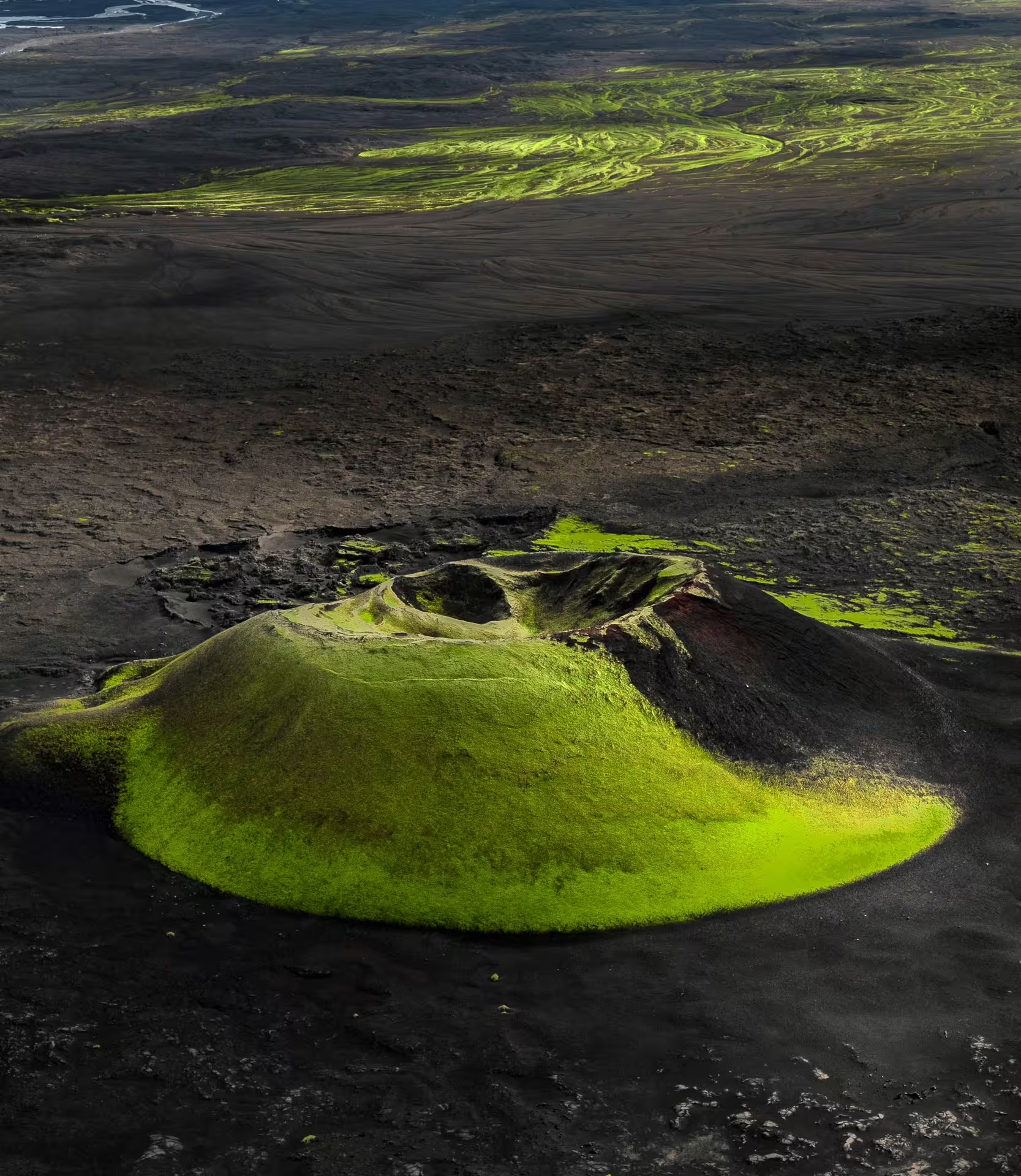
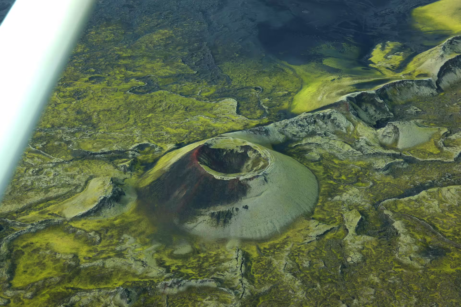
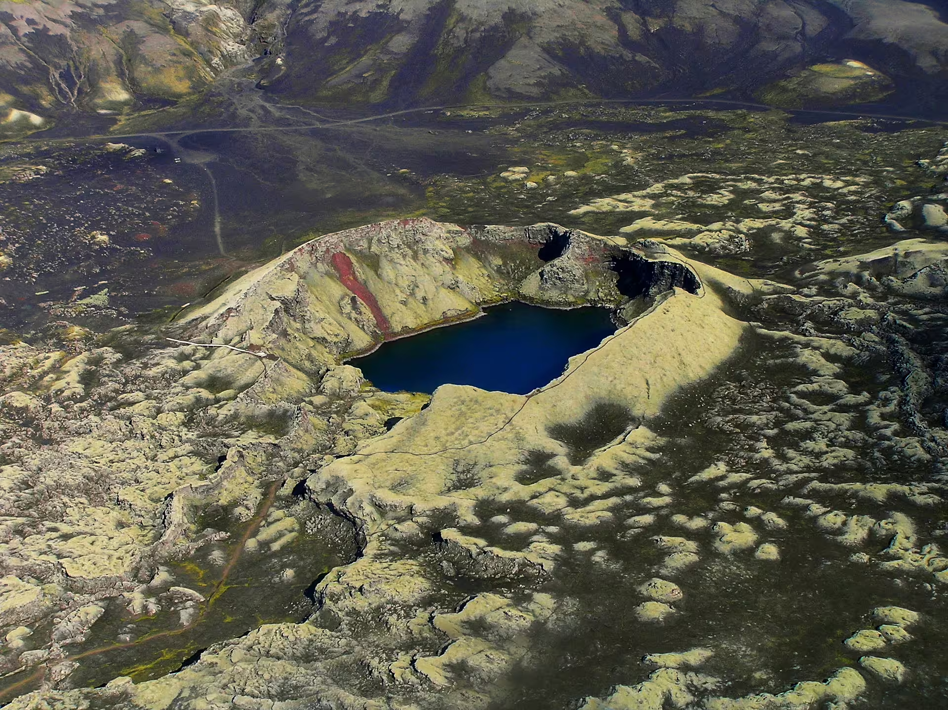
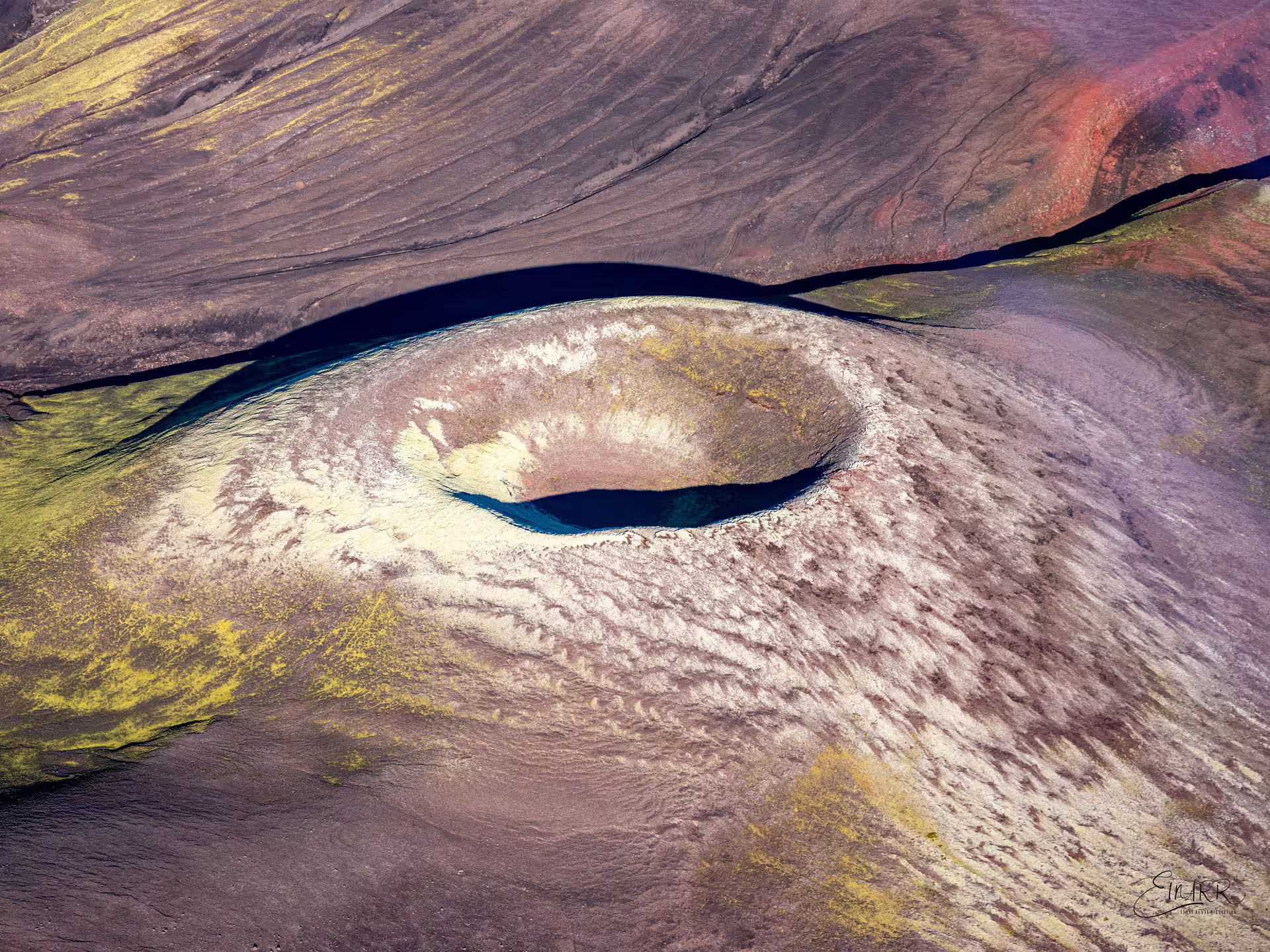
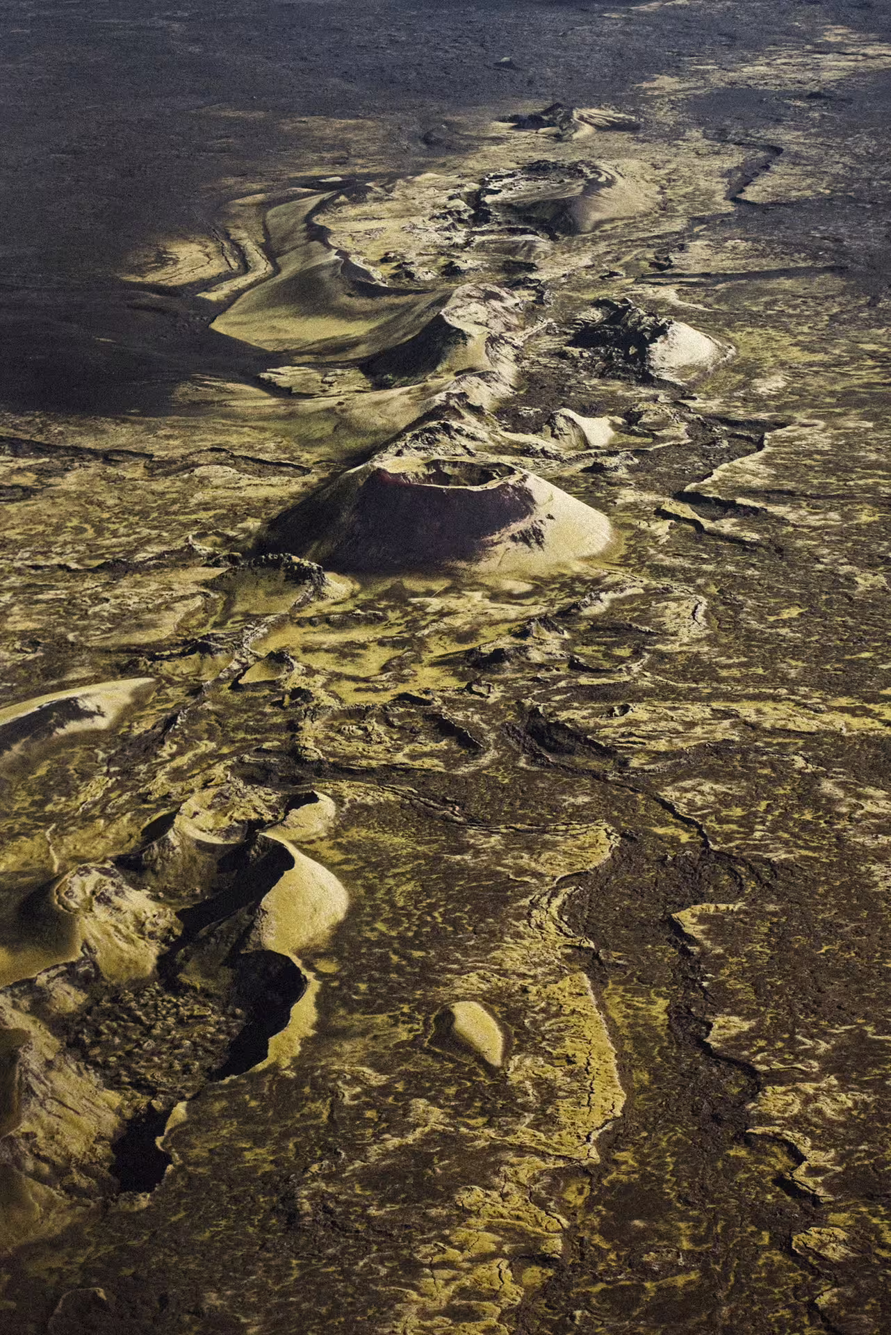
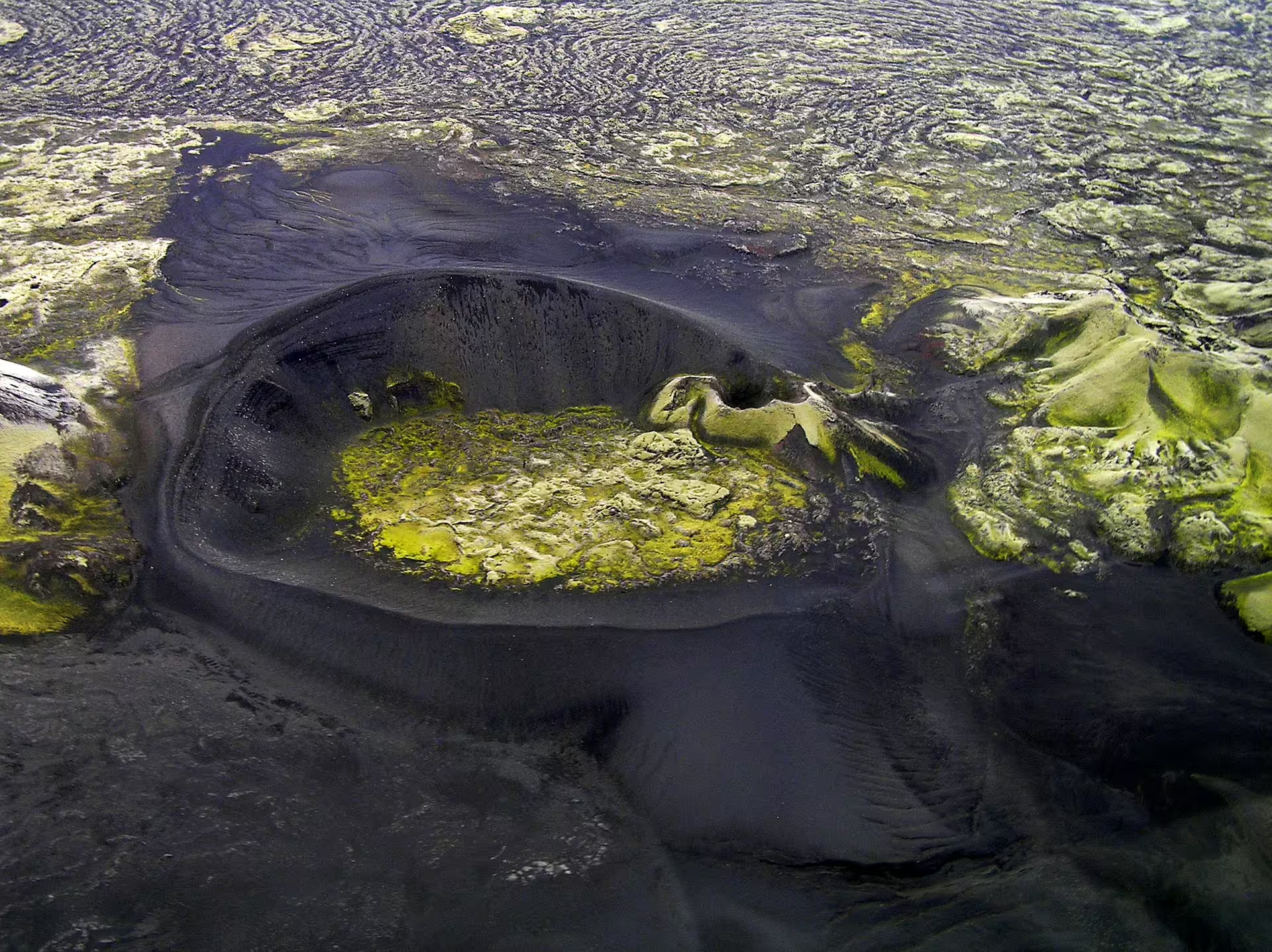
Fly over the Lakagígar crater chain, a 25 km fissure system formed during the 1783 eruption that ranks among Iceland's most significant volcanic events.
View the southern outlet glaciers of Vatnajökull, Europe's largest ice cap, on your way into the highlands.
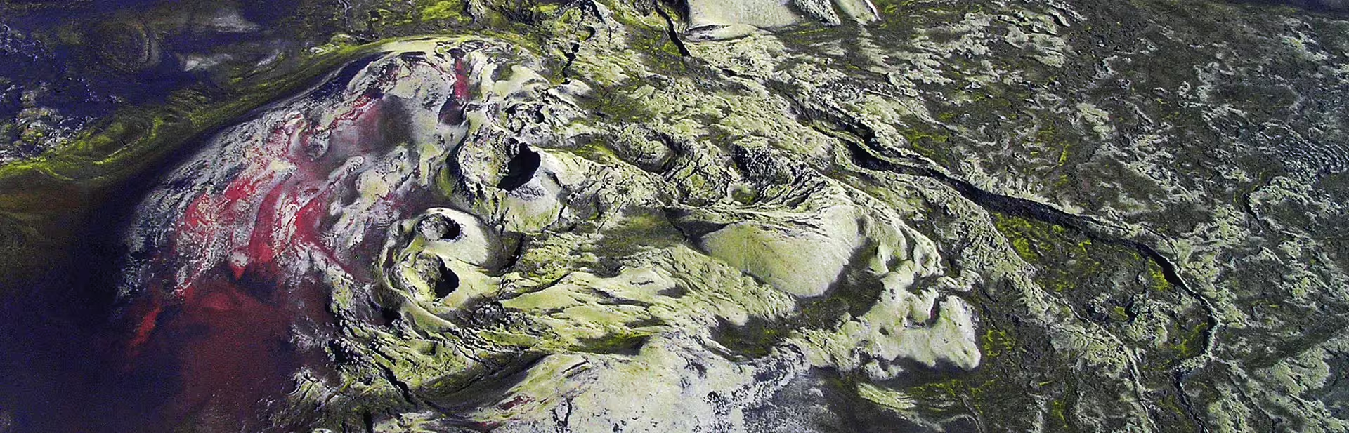
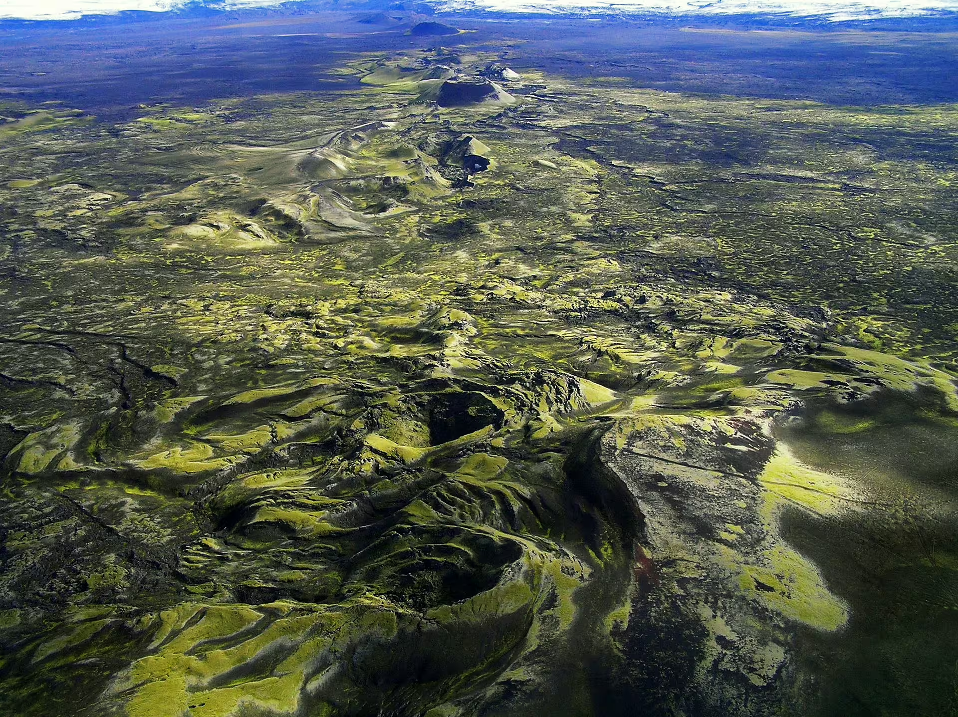
Survey the vast moss-covered lava fields stretching across the highland interior, a direct result of the 1783 eruption.
Depart from Skaftafell Terminal with a flight plan adapted in real time to current weather and visibility conditions.
Observe highland mountains and volcanic terrain from the air, providing context and scale impossible to gain from the ground.
Reach one of Iceland's most remote volcanic regions in just 50 minutes, without requiring multi-day highland trekking.
Flight Itinerary
Board the aircraft at Skaftafell Terminal. Your pilot briefs the group on the planned route and adjusts based on current weather and visibility conditions before take-off.
After departure, the route heads west over the southern edges of Vatnajokull, where outlet glaciers flow down from the ice cap. The contrast between ice and black volcanic rock is visible from the air.
The aircraft transitions from coastal glacial terrain into Iceland's remote interior highlands. The landscape below shifts to expansive lava fields, highland plateaus, and volcanic formations.
The flight reaches the Laki crater row, where the full 25-kilometer fissure system stretches across the terrain below. Crater after crater marks the path of the 1783 eruption from above.
The pilot navigates back toward Skaftafell, providing a second pass over the highland and glacial scenery before landing at the departure terminal.
What Is Included
Included
- 50-minute guided airplane tour
- Pilot commentary and route guidance
- Aerial views of Lakagígar crater chain
- Views over Vatnajokull outlet glaciers
- Departure and return from Skaftafell Terminal
Not Included
- Transport to Skaftafell Terminal
- Travel insurance
- Food and beverages
- Personal equipment or clothing
Important Information
Reserve Your Flight
Secure your place on this aerial tour over the Laki crater chain and Iceland's highland volcanic terrain. Availability is limited and subject to weather conditions.
Book Now